


Forêt de Montrichard

Pascal Bernaud
User

Length
11 km

Max alt
146 m

Uphill gradient
152 m
Km-Effort
13.1 km

Min alt
66 m

Downhill gradient
149 m
Boucle
No
Creation date :
2020-08-11 06:34:40.0
Updated on :
2020-08-11 09:07:06.176
2h32
Difficulty : Unknown

FREE GPS app for hiking
 SityTrail
IGN / Geographical institutes
SityTrail Plus
The world is yours!
About
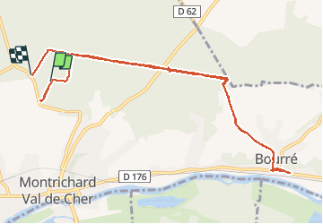
Trail Walking of 11 km to be discovered at Centre-Loire Valley, Loir-et-Cher, Montrichard Val de Cher. This trail is proposed by Pascal Bernaud.
Positioning
Country:
France
Region :
Centre-Loire Valley
Department/Province :
Loir-et-Cher
Municipality :
Montrichard Val de Cher
Location:
Unknown
Start:(Dec)
Start:(UTM)
362800 ; 5246470 (31T) N.
Comments